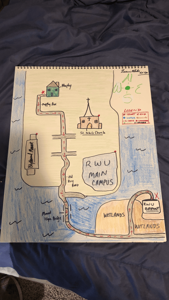

When I began thinking up my map, I decided to draw a map of how I would get to Baypoint from my off campus house. I chose Baypoint because it is a fun drive and they serve great lunch there.
Drawing a map in a sketchbook can be very hard. I wasn’t sure if I was properly drawing things, but after looking at the path from Google Maps, I found that I was pretty close. I chose these landmarks and roads because for the most part, it is a straight line and you only go on really two different roads. I was able to reduce uncertainty within my map by clearly drawing out key landmarks, such as a Manor, the campus, and the Mt. Hope Bridge. This way, people would be able to identify if they were going the right way based off of landmarks.
I really didn’t encounter that many issues once I knew what I was going for, and for my AHA moment, I knew I had produced a good map once I outlined the area. Visually imagining the area from above, I was able to pinpoint exact locations on the route that would make my map more clear.
If I had more time and resources, I would add in more landmarks and roads to better assist travelers who use my map. However, I showed my housemates my map and they had no issues following it. They said that the map would be useful for them if they had no idea where they were going.

